> Development > Rural Development


Literacy declining in Assam’s char areas
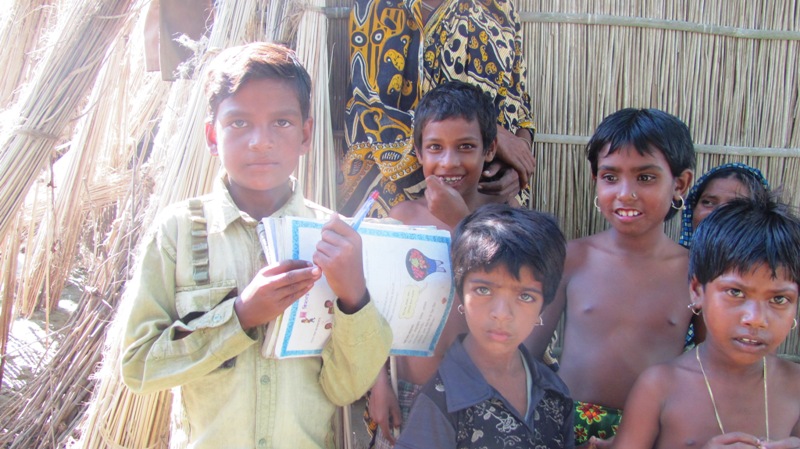
The head teacher stopped coming to No. 411 Alipur (Tapajuli Pathar) Lower Primary School two years ago. The assistant teacher, appointed through Teacher Eligibility Test, was an occasional visitor until he too began playing truant with the onset of the 2015 monsoon.
The residents of Tapajuli Pathar, a sandbar or river island (char/chapori) in western Assam’s Barpeta district, brought the duo’s absenteeism to the notice of the deputy commissioner and officials of the education department. It turned out to be a waste of time; the school established by the British government in 1945 stands today as just a structure with four walls and a roof. “Our children were perhaps destined to remain illiterates,” char dweller Abdur Razzak said.
Innumerable chars – detached from the geographical mainland – dot the 720km stretch of river Brahmaputra. Their unique geo-morphology aside, these chars are characterised by settlements, agricultural patches, muddy roads, periodic markets, schools and other public institutions. The chars cover 3,608 sq km of the Brahmaputra basin, which works out to 4.6% of Assam’s geographical area.
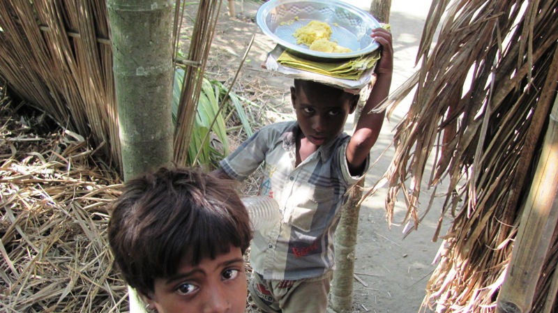
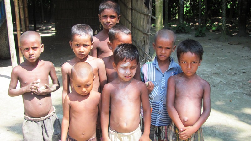
The char areas are distributed across 23 sub-divisions of 14 districts along the Brahmaputra’s course from Sadiya in the east to Dhubri in the west. An estimated 25 lakh people reside in 2,251 villages on these chars straddling 299 gaon panchayats. Some 68% of the char dwellers are below poverty line (BPL).
The chars are normally triangular in shape and are prone to erosion. The inhabitants lead an uncertain life with erosion often forcing them to shift their settlements – gradually from the river-eaten upstream end toward the downstream end where silt is simultaneously deposited. Erosion-displaced families prefer to relocate in the newly-created chars that take 3-4 years to settle down and be conducive for human habitation.
There has been no socio-economic survey of the char areas in more than a decade. The last significant one by the Assam State Char Areas Development Authority and the Directorate of Char Areas Development, Assam was in 2002-03. This survey revealed (see table below) literacy in the chars did not improve much from the 1992-93 scenario.
|
District |
No of chars |
Literacy rate 1992-93 |
Literacy rate 2002-03 |
|
Darrang |
121 |
10.12 |
12.34 |
|
Barpeta |
351 |
12.90 |
17.63 |
|
Kamrup |
148 |
16.85 |
15.16 |
|
Nalbari |
58 |
7.90 |
16.24 |
|
Bongaigaon |
150 |
12.85 |
12.46 |
|
Goalpara |
187 |
8.38 |
13.65 |
|
Dhubri |
313 |
19.06 |
14.60 |
|
Morigaon |
41 |
8.02 |
18.50 |
|
Nagaon |
29 |
9.44 |
17.59 |
|
Dhemaji |
95 |
14.44 |
15.69 |
|
Lakhimpur |
182 |
14.01 |
18.50 |
|
Sonitpur |
118 |
12.63 |
16.93 |
|
Tinsukia |
86 |
14.20 |
14.00 |
|
Jorhat |
210 |
31.90 |
60.55 |
Socio-Economic Survey Report, Directorate of Char Areas Development, 1992-93 and 2002-03
Even though the literacy rate in char areas increased from 15.45% during 1992-93 to 19.31% during 2003-04, it was much lower than Assam’s overall rate of 53.79 and 50.48 in rural Assam in 2001. If taken as one administrative unit, the chars under 59 development blocks and accounting for 9.35% of Assam’s total population form the most illiterate part of India. In 2011, the country’s least literate (36.10%) district was Alirajpur in Madhya Pradesh while Bijapur district of Chhattisgarh held this record in 2001 with 30.35%.
Even with such low literacy rates, the literacy rate in char areas of four districts – Kamrup, Bongaigaon, Dhubri and Tinsukia – has fallen, as indicated by the 2002-03 survey. One can relate this to a decline in the Muslim OBC literacy rate by 2 percentage points in 2011 from the 2001 census figure. But the char areas collectively exhibit a grim situation since no other geographical area in India has seen absolute fall in literacy rate.
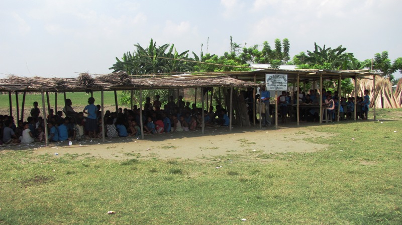
As per the 2002-03 survey, there are 1,852 lower primary schools, 574 middle schools, 218 high schools, eight higher secondary schools and 18 colleges to cater to the educational needs of the char dwellers. This, for a population of 25 lakh, means less than one lower primary school for 1,000 people and worse in the case of higher education. Moreover, these areas have a very high dropout rate for the male child at the primary school level.
Land ownership in these areas is extremely skewed with 10% of the population owning about 80% of the land. Most are small and marginal farmers while 30% are landless. Feudalism is the outcome of this uneven distribution of landed wealth, and falling literacy is providing the fuel it needs besides impacting social health.
The total fertility rate (TFR) in char areas, for instance, is higher than India’s 2.5 and even Bihar, which recorded the highest of 3.78 in 2011. A demographic study of 1,000 sample households in char villages of four development blocks in Barpeta and Kamrup districts revealed a TFR of 4.56. Unfortunately, there was no specific study in the districts where the literacy rate has declined.
The finding emphasised the fact that an illiterate woman in India bears 1.2 children more than a literate woman (average 2.2). The higher fertility rate has led to higher population density in the char areas – 690 per sq km against the state’s average of 340 per sq km. Higher population growth has also led to for poor health consciousness and lack of vertical mobility in these areas.
Angshuman Sarma
(Angshuman Sarma is a researcher at North Eastern Social Research Centre)
References
Agnihotri, SK, & Ray, BD (2002): Perspective of Security and development in North East India
Chakraborty, G (2009): Assam's Hinterland
Rajan, SI (2005): District Level Fertility Estimates for Hindus and Muslims
http://www.census2011.co.in/facts/lowdistrictliteracy.html